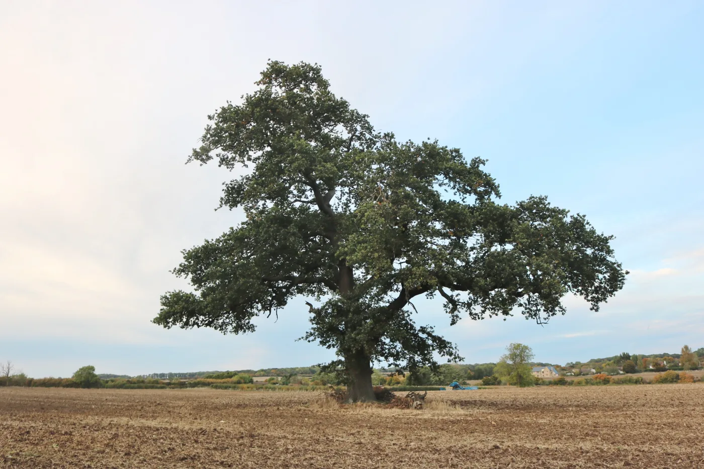

The 500MW Green Hill scheme was consented on 8 October. Its Milton Keynes site, 170.9 hectares north-west of Lavendon, keeps the two fields the council asked to have removed.
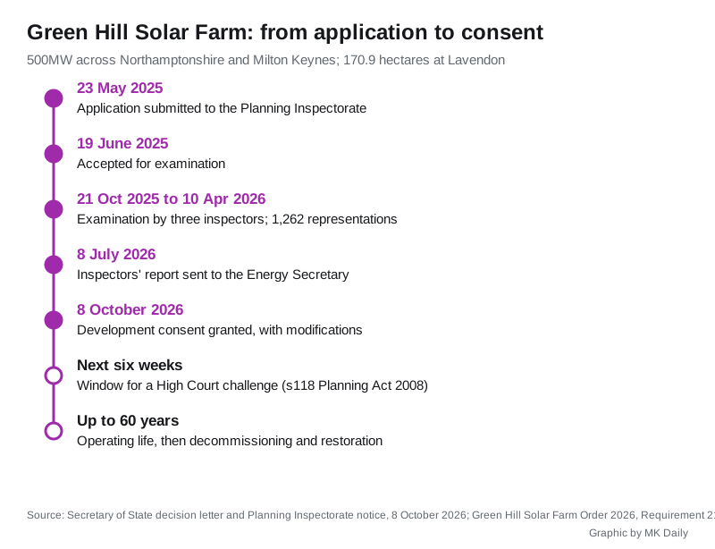
The Government has approved the Green Hill Solar Farm, a 500 megawatt scheme whose southern end sits on 170.9 hectares of farmland north-west of Lavendon. The decision was signed on 8 October by Minister Curran on behalf of the Energy Secretary, according to the decision letter.
Lavendon is a village on the A428 beyond Olney, roughly ten miles north-east of Central Milton Keynes. The Milton Keynes land is one of nine Green Hill sites. The rest lie in Northamptonshire, south and west of Wellingborough and north of Northampton.
The letter records that Milton Keynes City Council asked for two fields closest to the village, GF9 and GF13, to be taken out of the scheme. The Secretary of State refused. She found the council “did not provide sufficient information” to show that building on them would threaten the emerging MK City Plan 2050.
What was approved
The Planning Inspectorate’s notice describes the project as a solar generating station of up to 500MW with battery storage, a grid connection and the infrastructure to build and run it. The Development Consent Order covers:
- ground-mounted solar panels across sites in West Northamptonshire, North Northamptonshire and Milton Keynes
- a battery energy storage system
- underground cables of up to 400kV to National Grid’s substation at Grendon, in Northamptonshire
- new tracks, fencing, CCTV, planting and drainage ponds
- compulsory purchase and temporary possession powers, which run for five years from the day the Order is made
The developer is Island Green Power, through Green Hill Solar Farm Limited. Its project website says the output would be enough for about 200,000 homes. That is the developer’s figure, not the Government’s.
The scheme is a Nationally Significant Infrastructure Project because it exceeds 100MW. That means the council never had a vote on it. Its role was to write a Local Impact Report and argue its case at the examination.
The Milton Keynes site
The council’s Local Impact Report puts the whole Order land at 1,441.4 hectares, of which Site G, the Milton Keynes part, is about 170.9 hectares. Three quarters of Site G is best and most versatile farmland: 33% Grade 2, 42.7% Grade 3a and 24.3% Grade 3b, a total of 127.3 hectares that could not be farmed as arable land while the panels are there.
The Order names the Milton Keynes roads and tracks the developer may use:
- London Road, the A509
- the private track from Northampton Road, the A428, to Northey Farm
- the track from Northey Farm
- the tracks along the western and southern edges of Threeshire Wood
The council’s report says construction lorries will come from the A45 via the A509 and A428, “not through Lavendon, or Olney”. It forecasts an average of 8 HGV trips a day, peaking at 18 two-way movements, and 124 two-way movements a day in total at Site G, most of them workers’ cars and vans. Two abnormal loads are expected.
What the council asked for, and what it got
Milton Keynes City Council did not object to the principle. Its report says solar farms are “supported in principle” under policy SC3 of Plan:MK, subject to the applicant addressing its concerns. It then listed what it wanted secured:
- removal of fields GF9 and GF13, east of Lavendon bridleway BW15
- widening of the A428 construction access so two vehicles can pass
- permissive paths between the existing rights of way
- more landscaping along the A428 and the footpaths
- more bird and bat boxes
The two fields were the main point. The council said they fall within the proposed Ouse Valley Special Landscape Area in the MK City Plan 2050, and that panels there would be “highly visible on the landscape, particularly in the area around Lavendon”.
The Secretary of State sided with the developer. Her letter says the City Plan was still being examined when the Green Hill examination closed, so it carried “little weight”. She agreed with the inspectors that the council had not shown the fields were “critical to its delivery”.
Lavendon Parish Council made the same request. Its representation says the panels on GF9 would cover 4.3 hectares and those on GF13 12 hectares, so dropping both would cost 16.3 hectares out of a scheme of about 1,200. It says GF9’s access track would run within about 10 metres of Three Shires Wood, which is ancient woodland, and that GF13 is the field nearest the village and sits beside a watercourse in a village with “a well-documented history of flood incidents”. The parish says the developer told it at a meeting on 24 September 2025 that removing land was “not possible” because the project is Critical National Priority infrastructure.
Skylarks: the one point the council won on paper
Surveys found 286 skylark territories across the whole scheme. The council said the developer’s plan would displace 55.5% of them, and disputed the idea that more foraging land makes up for lost nesting land.
The Secretary of State wrote that she was “sympathetic to the concerns of MKCC”, noting that the developer does not own the surrounding farmland and cannot guarantee it will be there to absorb displaced birds for 60 years. She weighed the skylark impact negatively. The inspectors had counted biodiversity as a small point in the scheme’s favour; she moved it to neutral. It did not change the outcome.
Sixty years, then removal
The Order allows the solar farm to run for up to 60 years after it is fully commissioned. Both Northamptonshire councils and the Stop Green Hill group argued for a shorter life. The Secretary of State kept 60 years, pointing to the same period in the Mallard Pass, Cottam, West Burton, Gate Burton and Tillbridge solar consents.
Requirement 21 of the Order says the developer must notify each council at least 12 months before decommissioning any part, and submit a decommissioning plan for approval at least ten weeks before. Where a part crosses council boundaries, every council involved must approve it.
The planning balance
The letter sets out how each issue was weighed:
| Issue | Weight |
|---|---|
| Need for the development | Substantial positive |
| Agriculture and soil | Moderate negative |
| Historic environment | Moderate negative |
| Landscape and visual | Moderate negative |
| Socio-economic | Limited negative |
| Traffic and transport | Limited negative |
| Biodiversity | Neutral (inspectors said slightly positive) |
| Flood risk, glint and glare, noise, battery fire safety | Neutral |
The Secretary of State also rejected the argument, made by local MPs among others, that rooftop and car park solar around Northampton would be a better alternative. Decentralised energy, she wrote, does “not replace the need for new large-scale electricity infrastructure”.
The examination received 1,262 relevant representations. One detail for the record: the decision letter says the application was submitted on 23 May 2026. The Inspectorate’s own timeline, and the acceptance date of 19 June 2025 in the same letter, make clear that should read 2025.
Flooding in Lavendon
The council rated flood risk as neutral. But its report corrected the developer on one point: the Environmental Statement said the council’s Flood Alleviation Scheme for Lavendon “is no longer going ahead”. The council, as lead local flood authority, said it is still “seeking to develop” one, and asked the developer to share any flood modelling that could help the village.
What it means for you
- Living in Lavendon, Cold Brayfield or Warrington: the consent is final unless someone takes it to the High Court. There is no appeal. A judicial review must be lodged within the period set by section 118 of the Planning Act 2008, which is six weeks from publication of the decision.
- Driving the A428 or A509: construction traffic is routed from the A45 through Northamptonshire, not through Olney or Lavendon. The access off the A428 is to be widened.
- Walking the Three Shires Way or the Milton Keynes Boundary Walk: the council says no rights of way within Site G are to be closed, and permissive paths are planned between them.
- When does it start: no construction date has been published. The developer’s site gives none, and the Order’s commencement date is blank in the signed copy.
The full set of documents, including the inspectors’ report, is on the Planning Inspectorate’s project page. Our planning news page tracks the MK City Plan 2050 examination, which is where the Ouse Valley landscape designation will be settled.
Have your say