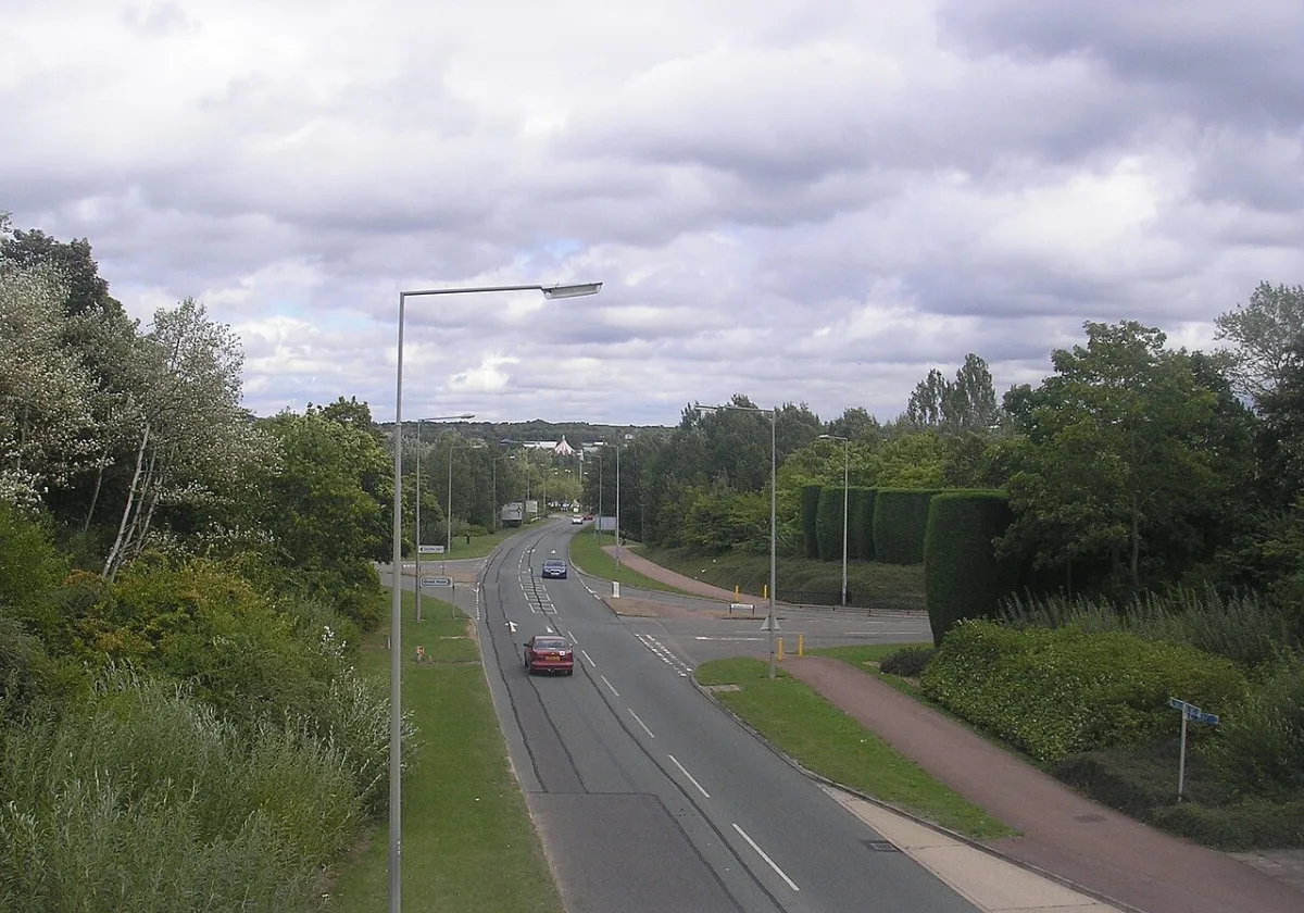

Secklow Gate northbound in CMK shuts 7 to 9 October and two A5 Portway slips close overnight. Childs Way at Oldbrook is due next, 12 to 15 October.
Checked 3 October 2026. The grid closure coming up is Secklow Gate in Central Milton Keynes. Its northbound carriageway shuts between Childs Way and Avebury Boulevard, 9.30am to 3.30pm, from Wednesday 7 to Friday 9 October, while Hutchinson 3G upgrades telecoms equipment. The signed diversion is Childs Way, Marlborough Street and Portway.
On the A5, National Highways is closing two slip roads at Portway overnight:
- Wednesday 7 October, 8pm to 6am: the southbound entry slip.
- Thursday 8 October, 8pm to 6am: the northbound exit slip.
Next on the grid is Childs Way (H6) at Oldbrook, between Grafton Street and Evans Gate, 9.30am to 4.30pm from Monday 12 to Thursday 15 October. The council has only given notice of that one so far.
The Grafton Street (V6) closure in Bradwell finished on 30 September.
From Monday 5 October, bus stops on Stratford Road in Wolverton move while the Agora is redeveloped. The council has now made that order, and it can run for up to 18 months.
Milton Keynes City Council receives between 600 and 1,000 permit applications a month from utilities and developers wanting to dig up a road. As the highway authority it cannot legally refuse them. It can only coordinate them. That is the honest reason there is always something being dug up somewhere on the grid.
This page lists the closures the council has formally ordered, checked against its own signed notices, then covers the things that do not change week to week: how the grid works, the schemes running through 2026, what parking costs, and where the park and ride is.
Closures in the next fortnight
Every closure below comes from a Temporary Traffic Regulation Order made under section 14 of the Road Traffic Regulation Act 1984, published by Milton Keynes City Council. Dates are the ones in the order. A TTRO gives the contractor a window, so a road may reopen early or not shut at all on a given day.
| Dates | Road | Extent and reason | Diversion |
|---|---|---|---|
| 5 to 16 Oct, 24 hours | Bury Close and Robert Peel Close, Newport Pagnell | Both their full length, construction works on a new development by Brennan Building and Civil Engineering | None |
| 7 Oct, 9.30am to 4.30pm | Theydon Avenue, Woburn Sands | Bow Brickhill Road to Elm Road, Anglian Water maintenance | Bow Brickhill Road, The Leys, Hardwick Road and Station Road |
| 7 to 9 Oct, 9.30am to 3.30pm | Secklow Gate, Central Milton Keynes | Northbound carriageway, Childs Way to Avebury Boulevard, Hutchinson 3G telecoms upgrade | Childs Way, Marlborough Street and Portway |
| 7 to 9 Oct, 24 hours | Sutherland Grove, Bletchley | Between numbers 21 and 41, Openreach ducting | Angus Drive, Forfar Drive and Whaddon Way |
| 7 to 9 Oct, 24 hours | Blackhill Drive, Wolverton Mill | Between Bluecube and Walnut House, Openreach ducting | None |
| 9 Oct, 9.30am to 3.30pm | Walton Road, Wavendon | Phoebe Lane to Kings Close, Openreach cabling | Passalewe Lane, Isaacson Drive, Fyfield Barrow, Tongwell Street, Groveway and Newport Road |
| 13 to 15 Oct, 8am to 4pm | Pindon End, Hanslope | Anglian Water maintenance (see note below) | A508, Yardley Road, Castlethorpe Road, Long Street Road and Higham Cross Road |
| 14 to 16 Oct | Cottingham Grove, Bletchley | Buckingham Road to outside number 10, Anglian Water maintenance | Buckingham Road |
| 27 Oct, 9am to 3.30pm | Lichfield Down, Walnut Tree | Between numbers 134 and 138, Anglian Water maintenance | Hindhead Knoll, Walton Road, Brickhill Street and Dunchurch Dale |
The council made all of these orders on 29 September, so they are no longer proposals. Secklow Gate is the one that changes journeys: it is one of the main ways into the centre from the south, and the diversion sends northbound traffic east along Childs Way to Marlborough Street, then back along Portway. Where the table says “None”, the council’s notice gives no alternative route.
The Pindon End notice describes the closed length in a garbled way: “from the railway bridge to its junction with its junction with Cranfield Road to its junction with Bozenham Mill Lane”. Expect the road between the railway bridge and Bozenham Mill Lane to be affected, and check the signs on the day.
Long closures carrying on
These two orders were made earlier and have since rolled off the council’s notices page, so we could not re-read them today. The dates below are the ones in the signed orders we read in September:
- Old Wolverton Road shuts on weekdays, 7.30am to 4pm, until 18 December for Network Rail’s railway bridge repairs. Diversion via Grafton Street, Millers Way and Great Monks Street. The order is TTRO-2436; an earlier notice for the same closure was filed as TTRO-2449.
- Lomond Drive in Bletchley stays shut round the clock until Friday 9 October, Sheelin Grove to Stoke Road, for National Grid ducting. Diversion via Stoke Road and Drayton Road.
Proposed for mid-October
The council has served notices of intent for these on 1 October. None has been made yet, so treat the dates as planned:
- 12 to 14 October, 24 hours: Lotherdale and Mossdale, Heelands, short lengths between numbered houses, Openreach ducting. No alternative route.
- 12 to 15 October, 9.30am to 4.30pm: Childs Way (H6), Oldbrook, between Grafton Street and Evans Gate, Hutchinson 3G telecoms work. Diversion via Grafton Street, Portway and Witan Gate.
- 14 October, 9.30am to 4.30pm: Glyn Square, Wolverton, its full length, for Cellnex steel installation. No alternative route.
Bus stops moving in Wolverton
The council made order TTRO-2497 on 29 September. From 5 October, only buses may wait or load on the westbound side of Stratford Road, Wolverton, from outside The North Western pub to Radcliffe Street. That is where the bus stops are being relocated during the Agora redevelopment. The order runs for 18 months or until the work is finished, whichever is sooner.
One we could not confirm
Our last check listed a notice of intent for Wastel, Beanhill, numbers 17 to 39, 5 to 7 October, for Openreach. No order for it appears on the council’s page today, so we cannot say whether it will go ahead.
All of the above comes from the council’s public notices page, re-read on 3 October.
Already closed, and staying closed
Footpath 14 at Moulsoe is shut for six months to allow earthworks and utility installation for a housing development. It is closed from its junction with Newport Pagnell Football Club for about 865 metres, with no alternative route. The notice printed in the Milton Keynes Citizen gives the dates as 15 August 2026 to 15 February 2027. The council’s own signed notice, which we read in August, gave 14 August to 14 February.
Redway AS04 at Ashland, 270 metres south of Newington Gate, is closed until 30 October under order TTRO-2425, with walkers and cyclists sent onto the parallel footways.
Closures that have now ended
If you saw signs for these, they are done:
- Grafton Street (V6) northbound, Bradwell, 28 to 30 September
- Petworth, Great Holm, Booker Avenue, Bradwell Common, and Cheriton, Furzton, all late September
- Dalvina Place, Hodge Lea, and Woodrush Close, Beanhill, 30 September to 2 October
- Calverton Lane, Calverton, and Mallow Gate, Conniburrow, to 25 September
The M1 and the A5
The M1 and the A5 are National Highways roads, not the council’s, and they appear in a separate report. Everything below comes from its seven-day closure report, last updated 2 October, covering Friday 2 to Thursday 8 October. It is refreshed on weekdays, so later nights may still be added.
The A5 through Milton Keynes has slip-road closures at Portway as part of horticulture work (cutting and planting) between Little Brickhill and Old Stratford:
- Wednesday 7 October, 8pm to 6am: the A5 southbound entry slip at Portway.
- Thursday 8 October, 8pm to 6am: the A5 northbound exit slip at Portway.
Nothing on the M1 between junctions 13 and 14 is shut this week. The closures nearest the district are:
- Monday 5 to Thursday 8 October, 9pm to 5am: the M1 northbound exit slip at junction 12, Toddington, for communications work.
- Thursday 8 October, 8pm to 6am: the A421 eastbound from M1 junction 13 to the Salford Road entry slip, in Bedfordshire, for resurfacing.
The overnight closure of the A5 northbound between Redmoor and Portway roundabouts finished at 5am on Saturday 3 October.
A standing order to know about
National Highways has an order closing two A5 lay-bys during music events: the northbound one about 200 metres north of the Standing Way overbridge and the southbound one about 225 metres south of the Chaffron Way overbridge. The order came into force on 27 July 2026 and can run for up to 18 months, taking effect only when the signs are out.
Trains
Re-checked against National Rail’s engineering works notices on 3 October.
Sunday 4 October, until 11:50. Work at Rugby closes some lines. Avanti trains between Rugby and Nuneaton run to slightly amended timings and will not run via Northampton; London Northwestern trains via Rugby are retimed until about 11:50 (notice).
Saturday 10 October, until 21:00. Work between Euston and North Wembley stops the Euston to Tring trains. London Northwestern trains between Euston and Milton Keynes Central, Northampton or Birmingham leave Euston slightly earlier and arrive slightly later (notice).
Saturday 17 October. The same work again. Trains that start or end at Tring do not run, and London Northwestern trains from Euston to Milton Keynes Central, Northampton and Birmingham leave Euston slightly earlier (notice).
The overnight Avanti diversions via Northampton on 29 September to 1 October are over.
Where to check live roadworks
The council uses one.network, and says it updates every few minutes. It is the same system the utilities file their permits into, so it is as close to the source as you can get without being the council.
On the map you can see who is doing the work, the start and end dates, and the diversion route if you hover over the icon. You can also set up free alerts for a specific area if you make an account, which is worth doing if there is one junction your commute depends on.
The council also publishes the signed notices themselves, as PDFs, which is where the closure table above comes from. Emergency works will not appear there, because they are done before an order can be made.
To report a pothole or a damaged road surface, use the council’s highways maintenance form.
The grid, and why it matters when a road shuts
Milton Keynes is the only English city where the road network is a numbered grid, and it is the reason a single closure behaves differently here than it would elsewhere.
Ten H roads run roughly east to west, numbered H1 in the north to H10 in the south. Eleven V roads run roughly north to south, V1 in the west to V11 in the east. H roads are named “Ways”, V roads are named “Streets”, which is a genuinely useful memory aid once you know it.
Almost every grid junction is a roundabout rather than a set of traffic lights, and the grid roads run between the estates rather than through them. That is why most of the network sits at national speed limit, with some sections reduced to 40mph, and why residential streets inside the squares are so quiet.
The practical consequence: because the grid is a mesh, a closure on one H or V road almost always has a parallel route one square over. When Chaffron Way (H7) is shut, Childs Way (H6) or Standing Way (H8) will usually take you the same direction. This is the opposite of a radial town, where closing the one road in means everybody queues. Check the map, then go one square north or south.
Several grid roads double as A roads and that is what you will see on motorway signs rather than the grid number:
- H3 Monks Way is the A422
- H5 Portway is the A509
- H8 Standing Way is the A421
- H10 Bletcham Way is the A4146
- V11 Tongwell Street is also the A4146
- V4 Watling Street is the old A5 line
The £6m resurfacing programme
Separate from the utility digs, the council is spending over £6m on this year’s resurfacing programme. It said in July that 11 roads would be fully resurfaced during August, meaning the old surface is planed off and a new layer of asphalt laid. The council says it picked them from its own inspections and from residents’ reports.
The 11 roads are:
- Aspreys, Olney
- V10 Brickhill Street, between H8 and H9
- Kingsmead Roundabout, H7 and V1
- V6 Grafton Street and North Grafton Roundabout, Central Milton Keynes
- Stratford Road, Wolverton
- Garamonde Drive, Two Mile Ash
- Snowdon Drive, Winterhill
- Chesney Wold, Bleak Hall
- Wolverton Road, Newport Pagnell
- Cricket Green and Green Lane Roundabout
- South Witan Roundabout, Central Milton Keynes
That followed a month of surface dressing, a cheaper treatment that seals a road that is worn but still structurally sound. Crews covered 14 roads, which the council put at roughly the area of 30 football pitches.
Kerrie Bradburn, the cabinet member for highways and transport, said surface treatments “help to prevent potholes forming which will help to keep the roads smooth and well maintained in the long term”.
The council published this list on 27 July and has still not updated it, checked again on 16 September, so the August programme has run its course without a published account of what was actually finished.
Schemes running in 2026
These are the council’s current major highways projects. They are longer-running than a utility dig, so they are worth planning around.
- Queensway, Bletchley. The big one. Queensway is becoming a one-way system from Albert Street to Princes Way, with a two-way cycle path, raised table crossings, new drainage and lighting, disabled parking bays and planting. It is funded through the New Town Deal. The completion month has now arrived and the council has not said whether it will be met. Its most recent published update, checked again on 16 September, is still the one from July 2026: that said the final stage around Stanier Square would take six to eight weeks after the Bletchley Big Street Eat on 25 July, leaving the project on track for completion in September 2026. Six weeks from 25 July was 5 September, which has passed with nothing published. Eight weeks is this Saturday, 19 September.
- Princes Way and Saxon Street, Bletchley. Work to improve connections between the transport hubs and the town centre, scheduled for 2026 as part of the wider Bletchley programme.
- Brinklow and Monkston roundabouts. Roundabout redesigns, currently at consultation and planning stage rather than on site.
- H10 Bletcham Way extension. The H10 grid road is being extended to serve planned growth in the south east of the city.
- MK East Housing Infrastructure Fund works. Highway schemes supporting the eastern expansion, which is also the largest housing allocation in the MK City Plan 2050.
- Wolverton Agora. Highway and transport improvements alongside the redevelopment of the former Agora site.
Parking in Central Milton Keynes
CMK has more than 20,000 parking spaces, and the bays are colour coded. Charges apply from 7am to 6pm daily, except Christmas Day and Easter Sunday.
| Bay | Type | Charge |
|---|---|---|
| Purple | Standard | £1 an hour for the first two hours, then 50p an hour (two-hour minimum) |
| Red | Premium, closest in | £2.50 for the first hour, then £2 an hour |
| Blue | Long stay | £10 all day |
Payment is cashless through RingGo. Motorcycles park free in motorcycle bays and in pay and display areas. The Elder Gate multi-storey has 700 spaces, opens 6am to midnight on weekdays and has a 2.1 metre height limit.
If you are catching a train rather than shopping, the station car park is separate and dearer: see the tariffs on our Milton Keynes trains to London page.
Park and ride
Milton Keynes has one park and ride, at MK Coachway, just off junction 14 of the M1 on the A509. Parking there is free, and buses run into the city.
Route 3, run by Arriva, is the main connection into Central Milton Keynes and runs up to every 20 minutes Monday to Saturday and hourly on Sundays. Routes C1, C11 and X5 also call there. Arriva sells a £5.00 Group Day Return valid for one round trip for up to five adults or children between the Coachway and Central Milton Keynes railway station, which is the cheapest way to get a family into the centre for the day. Pay the driver by cash or contactless, or buy in the Arriva app.
Cycling and the redways
The redway network is the other half of the grid. It is a separate system of shared paths for pedestrians and cyclists, using underpasses and bridges to cross the grid roads rather than junctions. Because it is grade separated from the traffic, a grid road closure usually does not affect it at all, which makes it the reliable option on a bad traffic day if your journey is short enough. Two closures are booked. Redway BA01 and bridleways BW01 and BA06 at Bradwell Abbey shut again on 14 September for Network Rail brickwork repairs, with the alternative signed via redways BA02, BW02 and BW03. Redway AS04 at Ashland closes from 28 September to 30 October, with walkers and cyclists sent onto the parallel footways.
What it means for you
- Old Wolverton Road is now shut on weekdays, 7.30am to 4pm, between Haversham Roundabout and Wolverton Park Road, until 18 December. The order has been made. Go via Grafton Street, Millers Way and Great Monks Street.
- Lomond Drive, Bletchley is shut round the clock until 9 October between Sheelin Grove and Stoke Road. Go via Stoke Road and Drayton Road.
- Do not drive up the M1 to Milton Keynes late on Saturday 19 September. The northbound carriageway is closed from junction 11A to junction 13, 9pm to 5am.
- Do not plan a train to London before 4pm on Sunday 20 September. Nothing runs from Milton Keynes Central to Euston until then. An Avanti ticket for that day is valid from Friday 18 to Tuesday 22 September instead.
- Heading towards Bedford on Sunday night? The A421 eastbound is shut from M1 junction 13 to Marsh Leys, 8pm to 6am.
- If you live on Darnel Close in Beanhill or Dunster Court in Furzton, Openreach closures are booked for 21 to 24 and 23 to 25 September, with no alternative route.
- When a grid road shuts, go one square over. The mesh means a parallel H or V road nearly always runs the same direction, which is why a closure here behaves very differently from one in a radial town.
- If you park on Melrose Avenue, Dorchester Avenue, Whalley Drive or Banburies Close in West Bletchley, the double yellow lines have been enforceable since 21 August, and the window to challenge the order in the High Court closes on 29 September.
- Check one.network before you set off, not the day before. Emergency works never make it into a published order.
- For a day in CMK, blue bays at £10 all day beat red bays at £2.50 for the first hour if you are staying more than about four hours.
- For a family trip in, the Coachway park and ride is free to park plus £5.00 for up to five people return.
Sources
- Milton Keynes City Council, Public Notices (Highways), re-checked 19 September 2026 and unchanged since 16 September, for the signed notices still listed: notices of making for TTRO-2482 (Lomond Drive) and the notice of intent TTRO-2449 (Old Wolverton Road), whose text we re-read.
- Milton Keynes City Council public notices served on 10 September 2026, via the Public Notice Portal, read 16 September 2026, for TTRO-2460 (Darnel Close), TTRO-2462 (Dunster Court) and the orders made on 8 September for Old Wolverton Road (TTRO-2436), Calverton Lane (TTRO-2481) and Mallow Gate (TTRO-2453).
- Milton Keynes City Council public notices served on 20 August 2026 and 6 August 2026, via the Public Notice Portal, for the surviving TTRO-2425 dates, the Moulsoe footpath and TRO-450.
- National Highways road closure report, the seven-day report published 18 September 2026 and covering 18 to 24 September, downloaded 19 September, for the M1, A421 and A5.
- National Rail engineering works notices, re-read 19 September 2026: London Euston to Watford Junction and Milton Keynes Central, 20 September, the 22:50 Birmingham New Street to Northampton, 21 to 24 September, Rugby, 27 September and Milton Keynes and Northampton midweek, 29 September to 1 October.
- Milton Keynes City Council, “Summer of work to repair and extend the life of city roads”, 27 July 2026 for the £6m resurfacing programme and the 11 roads.
- Milton Keynes City Council, roadworks and road maintenance for one.network, permit volumes and reporting.
- one.network live roadworks map
- Milton Keynes City Council, major projects and the Queensway improvement scheme page for the 2026 scheme list and the July 2026 update, re-checked 16 September 2026.
- National Highways A5 lay-bys order for the music event lay-by closures.
- Milton Keynes City Council, where to park and charges for CMK tariffs.
- Get Around MK, MK Park and Ride for the Coachway park and ride and fares.
- Milton Keynes grid road system for the H and V road names and numbering.
Roadworks change daily and dates slip. Always check one.network on the day.
Have your say